Exploring the Potential of Satellite Image Processing: Applications and Future Developments
This blog article delves into the many applications of satellite image processing, from disaster management to climate change research. It also discusses the challenges and future developments in the field, including the use of machine learning and high-resolution imagery. Discover the potential of satellite image processing and its impact on various industries.

Satellite image processing is the art of transforming raw satellite imagery into meaningful information that can be used for a variety of applications. This technology has come a long way in recent years, thanks to advances in computer processing power, software algorithms, and machine learning techniques. In this blog post, we will explore the basics of satellite image processing and its applications.
What is Satellite Image Processing?
Satellite image processing is the process of analyzing data obtained from satellite imagery. Satellites can capture images of the earth's surface from a variety of spectral bands, including visible, near-infrared, and thermal infrared. These images are often used to monitor the earth's surface for a variety of applications, including weather forecasting, environmental monitoring, land use and land cover mapping, urban planning, and military surveillance.
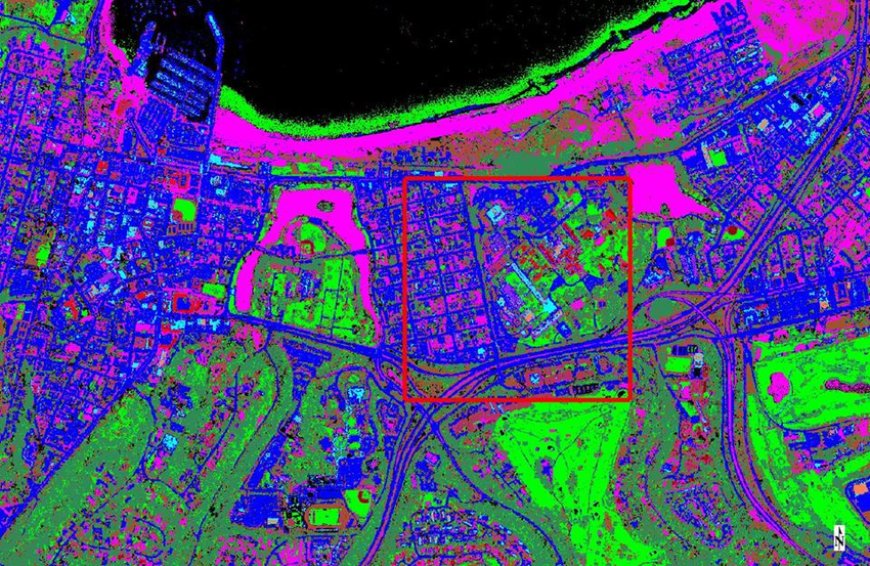
Satellite image processing involves a series of steps, including preprocessing, image enhancement, image classification, and feature extraction. Preprocessing involves correcting for atmospheric effects, geometric distortions, and radiometric errors. Image enhancement techniques are used to improve the quality and clarity of the images. Image classification involves identifying different objects in the image, such as land cover classes, and assigning them to different categories. Feature extraction involves identifying specific features of interest in the image, such as buildings, roads, and water bodies.
Applications of Satellite Image Processing
Satellite image processing has a wide range of applications, including the following:
-
Weather Forecasting: Satellite imagery is used extensively in weather forecasting. Satellites can capture images of the earth's surface, which can be used to monitor weather patterns, track storms, and predict severe weather events such as hurricanes, tornadoes, and floods.
-
Environmental Monitoring: Satellite imagery is also used for environmental monitoring. It can be used to track changes in vegetation cover, monitor deforestation, detect wildfires, and monitor the health of marine ecosystems.
-
Land Use and Land Cover Mapping: Satellite imagery is also used for land use and land cover mapping. It can be used to monitor changes in urbanization, agriculture, and forestry, and to identify areas of land use change.
-
Urban Planning: Satellite imagery is also used for urban planning. It can be used to identify areas of high population density, monitor traffic patterns, and identify areas of urban sprawl.
-
Military Surveillance: Satellite imagery is also used for military surveillance. It can be used to monitor enemy activity, track troop movements, and identify potential targets for military strikes.
Challenges in Satellite Image Processing
While satellite image processing has come a long way in recent years, there are still many challenges to overcome. Some of the key challenges include the following:
-
Data Volume: One of the biggest challenges in satellite image processing is the sheer volume of data that needs to be processed. Satellites can capture huge amounts of data, which can be difficult to manage and process.
-
Cloud Cover: Cloud cover can be a significant challenge in satellite image processing. Clouds can obscure the earth's surface, making it difficult to obtain clear images.
-
Atmospheric Effects: Atmospheric effects such as haze and dust can also be a challenge in satellite image processing. These effects can distort the images and make it difficult to identify specific features.
-
Geometric Distortions: Geometric distortions can also be a challenge in satellite image processing. These distortions can occur due to variations in altitude, camera angle, and terrain, and can make it difficult to accurately identify features in the image.
-
Radiometric Noise: Radiometric noise can also be a challenge in satellite image processing. This noise can occur due to variations in the sensor's sensitivity, and can affect the accuracy of the image.
In addition to the applications mentioned above, satellite image processing can also play an important role in disaster management and emergency response. Satellite imagery can be used to assess the extent of damage caused by natural disasters, such as earthquakes, hurricanes, and floods, and to identify areas that are in need of assistance. This information can be used to help emergency responders allocate resources more efficiently and to coordinate relief efforts.
Satellite image processing also has important applications in agriculture and forestry. Satellite imagery can be used to monitor crop health, identify areas of water stress, and detect disease outbreaks. In forestry, satellite imagery can be used to monitor the extent of deforestation, detect illegal logging, and track the spread of forest fires.
One of the most promising applications of satellite image processing is in the field of climate change research. Satellite imagery can be used to monitor changes in the earth's climate, such as changes in sea level, ice cover, and temperature. This information can be used to help scientists better understand the impacts of climate change and to develop strategies for mitigating its effects.
Conclusion
In conclusion, satellite image processing is a powerful technology that has the potential to revolutionize many industries. It can be used for a wide range of applications, from weather forecasting and environmental monitoring to urban planning and military surveillance. While there are still challenges to overcome, such as data volume and cloud cover, advances in technology and machine learning are helping to make satellite image processing more effective and efficient. As we continue to explore the possibilities of this technology, we can expect to see even more applications and benefits in the future.
Satellite image processing is an important technology that has many applications in a variety of fields. It has come a long way in recent years, thanks to advances in computer processing power, software algorithms, and machine learning techniques. However, there are still many challenges that need to be addressed in order to make satellite image processing more effective and efficient.
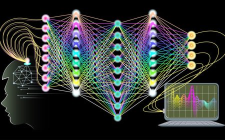
Future developments in satellite image processing may involve the use of advanced machine learning techniques, such as deep learning, to automate the process of image classification and feature extraction. This could help to overcome some of the challenges associated with data volume and processing time, and could lead to more accurate and detailed information being extracted from satellite imagery. Another area of development is the use of high-resolution satellite imagery. Advances in technology have led to the development of satellites that can capture images with resolutions as high as 30 cm. This high-resolution imagery could be used for a variety of applications, including urban planning, infrastructure development, and military surveillance. Overall, satellite image processing is a rapidly evolving field that has the potential to revolutionize many industries. As technology continues to advance, we can expect to see even more applications and benefits of this technology in the future.
What's Your Reaction?


