10 Fascinating Applications of Geoinformatics You Need to Know About
This blog explores 10 fascinating applications of geoinformatics, from environmental science to urban planning, agriculture, natural resource management, public health, emergency management, transportation, geology, tourism, and military. Discover how geoinformatics is transforming various industries by collecting, analyzing, and visualizing spatial data.

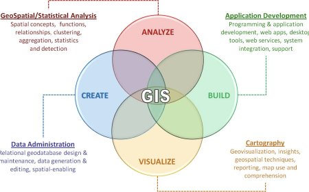
Geoinformatics is an interdisciplinary field that combines geographical information systems (GIS), remote sensing, and other spatial technologies to analyze and manage spatial data. In recent years, the use of geoinformatics has grown significantly, and it has found its applications in various fields. In this blog, we will explore the applications of geoinformatics and how it is transforming different industries.
- Environmental Science
Geoinformatics is playing an important role in understanding and managing the environment. It is being used to monitor and analyze various environmental factors, such as air quality, water quality, and land-use changes. With the help of satellite imagery and GIS, geoinformatics is enabling scientists to study the effects of climate change and natural disasters on the environment. For instance, it can be used to monitor the movement of glaciers and the melting of ice caps, which can help in understanding the impact of global warming.
Moreover, geoinformatics is being used in environmental management to monitor the spread of invasive species, study the impact of human activities on wildlife habitats, and develop conservation plans for biodiversity hotspots. It is also being used to model and predict the occurrence of natural disasters, such as floods, earthquakes, and landslides, which can help in disaster mitigation and management.
- Urban Planning
Geoinformatics is transforming urban planning by providing planners with accurate and timely information about the built environment. It can be used to collect data on population density, land-use patterns, transportation networks, and infrastructure, which can help in identifying areas for development and infrastructure improvements. Additionally, geoinformatics can be used to model the impact of urbanization on the environment and develop sustainable urban development plans.
- Agriculture
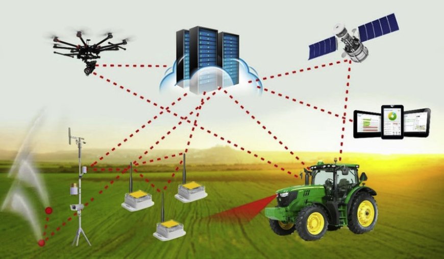
Geoinformatics is also being used in agriculture to improve crop production and management. With the help of GIS and remote sensing, farmers can monitor crop growth, soil moisture, and nutrient levels, which can help in optimizing the use of fertilizers and pesticides. Moreover, geoinformatics can be used to map and monitor the spread of pests and diseases, which can help in controlling their spread and minimizing crop damage.
- Natural Resource Management
Geoinformatics is playing a vital role in natural resource management, particularly in the management of forests, water resources, and minerals. With the help of satellite imagery and GIS, geoinformatics can be used to monitor and map forest cover and changes in land use. It can also be used to monitor water quality and quantity, which can help in developing water management plans. Additionally, geoinformatics can be used in mining to identify mineral deposits and plan mining activities.
- Public Health
Geoinformatics is also being used in public health to map and monitor the spread of diseases and identify high-risk areas. With the help of GIS, health professionals can map disease outbreaks, monitor the spread of infectious diseases, and develop disease control strategies. Geoinformatics can also be used to analyze and map environmental factors that affect public health, such as air pollution, water quality, and access to healthcare facilities.
- Emergency Management
Geoinformatics is playing a critical role in emergency management by providing real-time information about natural disasters, such as floods, earthquakes, and hurricanes. With the help of GIS and remote sensing, emergency responders can assess the extent of the damage, identify areas of high risk, and develop evacuation plans. Geoinformatics can also be used to monitor and map the spread of wildfires, which can help in developing fire management strategies.
- Transportation
Geoinformatics is also being used in transportation to improve the efficiency of transportation networks and reduce congestion. With the help of GIS, transportation planners can map transportation networks, identify areas of congestion, and develop traffic management strategies. Additionally, geoinformatics can be used to track and monitor the movement of vehicles and goods, which can help in optimizing routes and reducing transportation costs. Moreover, geoinformatics can be used to develop intelligent transportation systems that use real-time data to manage traffic flow and reduce accidents.
- Geology
Geoinformatics is also being used in geology to study the Earth's surface and subsurface. With the help of GIS and remote sensing, geologists can map and analyze the distribution of rocks, minerals, and other geological features. Additionally, geoinformatics can be used to monitor and model geological hazards, such as earthquakes, landslides, and volcanic eruptions, which can help in disaster mitigation and management.
- Tourism
Geoinformatics is transforming the tourism industry by providing tourists with accurate and timely information about tourist destinations. With the help of GIS, tourists can access maps and information about tourist attractions, accommodations, and transportation. Additionally, geoinformatics can be used to develop tourism management plans that balance the needs of tourists and the environment.
- Military
Geoinformatics is also being used in military applications to support mission planning and execution. With the help of GIS and remote sensing, military planners can analyze and map terrain, identify areas of interest, and develop battle plans. Additionally, geoinformatics can be used to track and monitor the movement of troops and vehicles, which can help in optimizing routes and reducing casualties.
However, despite the numerous benefits of geoinformatics, it also presents some challenges. For instance, it requires specialized skills and equipment, which can be expensive and difficult to obtain in some regions. Additionally, there are concerns about data privacy and security, particularly with regards to sensitive information such as military and intelligence data.
Nevertheless, the benefits of geoinformatics outweigh the challenges, and its applications are only expected to grow in the coming years. As technology advances and new spatial data sources become available, geoinformatics will continue to play a critical role in addressing some of the most pressing challenges facing society.
Conclusion
In conclusion, geoinformatics is a rapidly evolving field that has found numerous applications in various industries. From environmental science to urban planning, agriculture, natural resource management, public health, emergency management, transportation, geology, tourism, and military, geoinformatics has transformed the way we collect, analyze, and visualize spatial data. As the field continues to grow, it is likely to find even more applications in fields such as energy, finance, and social science. However, as with any technology, there are also challenges that need to be addressed, such as data privacy and security, and access to specialized skills and equipment. Overall, geoinformatics presents a tremendous opportunity for improving our understanding of the world around us and addressing some of the most pressing challenges facing society.
What's Your Reaction?


