Exploring Mars: Geospatial Mapping and the Quest for Extraterrestrial Life
Explore the intriguing world of Mars and its potential for extraterrestrial life through geospatial mapping. Uncover the mysteries of the Red Planet and its geological history. Join us on an exciting quest of discovery.

Introduction
Welcome to our comprehensive guide on exploring Mars and the fascinating field of geospatial mapping in the quest for extraterrestrial life. In this article, we will delve into the intricate details of Mars exploration, highlighting the significant role that geospatial mapping plays in uncovering the mysteries of the Red Planet. Join us as we embark on a thrilling journey of discovery and scientific exploration.
Unraveling the Mysteries of Mars
Mars: The Red Planet
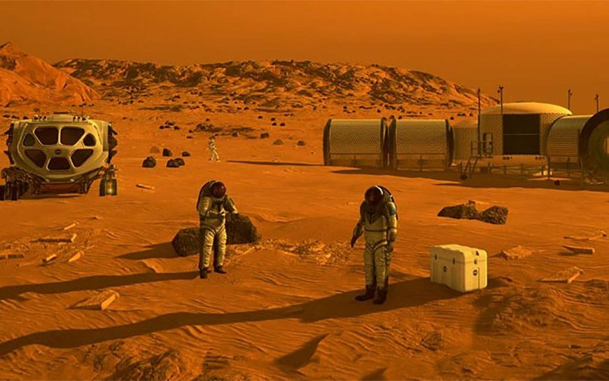
Mars, also known as the Red Planet, has captured the imagination of humanity for centuries. Its barren and rugged terrain, rusty reddish hue, and potential for extraterrestrial life have made it a prime target for exploration. With its proximity to Earth and relatively similar geological characteristics, Mars presents a unique opportunity for scientific investigation.
The Significance of Geospatial Mapping
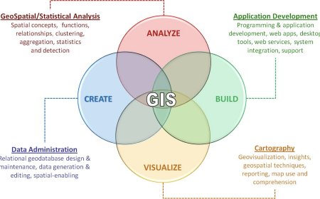
Geospatial mapping, a field that combines geography and technology, plays a pivotal role in understanding the topography and composition of Mars. By utilizing advanced imaging techniques and satellite data, scientists can create detailed maps and visualizations of the planet's surface, enabling them to uncover valuable insights into its geological history and potential habitability.
Unveiling Mars Through Geospatial Data
Geospatial data obtained from satellites and rovers provide scientists with a wealth of information about Mars. By analyzing these datasets, researchers can identify key features such as mountains, valleys, craters, and ancient riverbeds. These data points help paint a vivid picture of Mars' past, including its climate, potential water sources, and even the possibility of past or present life.
The Role of Geospatial Mapping in the Search for Extraterrestrial Life
Assessing Habitability
One of the primary objectives of geospatial mapping on Mars is to assess the planet's habitability. Scientists search for evidence of liquid water, a crucial ingredient for life as we know it. By examining geological formations and the presence of certain minerals, researchers can determine if conditions on Mars were ever suitable for sustaining life or if they exist presently in underground reservoirs.
Identifying Potential Life Hotspots
Geospatial mapping allows scientists to identify potential "life hotspots" on Mars, areas where the conditions might be favorable for microbial life. These hotspots could include regions with subsurface ice, geothermal activity, or areas where liquid water may have once existed. By pinpointing these locations, future missions and exploration efforts can be directed towards maximizing the chances of discovering extraterrestrial life.
Mapping the Martian Atmosphere
Geospatial mapping is not limited to the surface of Mars. It also encompasses the mapping of the planet's atmosphere, providing valuable data on its composition and dynamics. By studying the atmosphere, scientists can gain insights into Mars' climate patterns, seasonal changes, and the potential for volatile organic compounds (VOCs) that could indicate the presence of life.
Future Prospects: Advancements in Geospatial Mapping
High-Resolution Imaging
Advancements in technology continue to revolutionize geospatial mapping capabilities. High-resolution imaging systems, such as those onboard the Mars Reconnaissance Orbiter, capture detailed images of Mars' surface, allowing scientists to zoom in on specific features and analyze them with unprecedented clarity. These advancements greatly enhance our understanding of the planet's geology and the potential for extraterrestrial life.
Integration of Artificial Intelligence
The integration of artificial intelligence (AI) with geospatial mapping holds tremendous promise for Mars exploration. AI algorithms can analyze vast amounts of data, identify patterns, and assist in the identification of potential life indicators. By leveraging AI, scientists can accelerate the discovery process and narrow down the areas of interest for future missions.
Conclusion
In conclusion, geospatial mapping is a crucial component in our ongoing exploration of Mars and the search for extraterrestrial life. By utilizing advanced technologies and analyzing geospatial data, scientists can unlock the secrets of the Red Planet and bring us closer to answering the age-old question: Are we alone in the universe? Exciting times lie ahead as we continue to push the boundaries of scientific knowledge and embark on new missions to unravel the mysteries of Mars.
What's Your Reaction?


