The Power of Geospatial Technology: How It's Revolutionizing Disaster Response
Discover the transformative impact of geospatial technology in disaster response. Explore how it enhances preparedness, provides real-time situational awareness, enables effective resource management, improves communication, and leverages predictive analytics. Learn how geospatial technology is revolutionizing disaster response for safer and more efficient outcomes.

Introduction
In today's world, the power of geospatial technology has become increasingly evident, especially when it comes to revolutionizing disaster response. By harnessing the capabilities of geospatial technology, organizations and governments around the globe have been able to enhance their disaster preparedness, response, and recovery efforts. This article delves into the transformative impact of geospatial technology in disaster response, highlighting its key applications, benefits, and the ways it empowers stakeholders to make informed decisions during times of crisis.
Geospatial Technology: Unleashing Its Potential
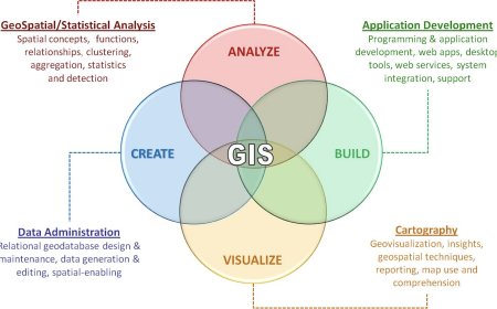
Geospatial technology refers to the science, tools, and techniques used to collect, analyze, and visualize geographic information. It encompasses various technologies such as Geographic Information Systems (GIS), Global Positioning Systems (GPS), remote sensing, and spatial analysis. These tools, when utilized effectively, provide a wealth of data and insights that are critical in disaster response operations.
Enhancing Preparedness and Planning
One of the primary benefits of geospatial technology in disaster response is its ability to enhance preparedness and planning efforts. By leveraging geospatial data, response teams can identify high-risk areas prone to disasters, enabling them to develop comprehensive emergency plans tailored to the specific needs of each region. GIS-based mapping allows for the identification of vulnerable populations, critical infrastructure, evacuation routes, and the allocation of resources strategically.
Real-Time Situational Awareness
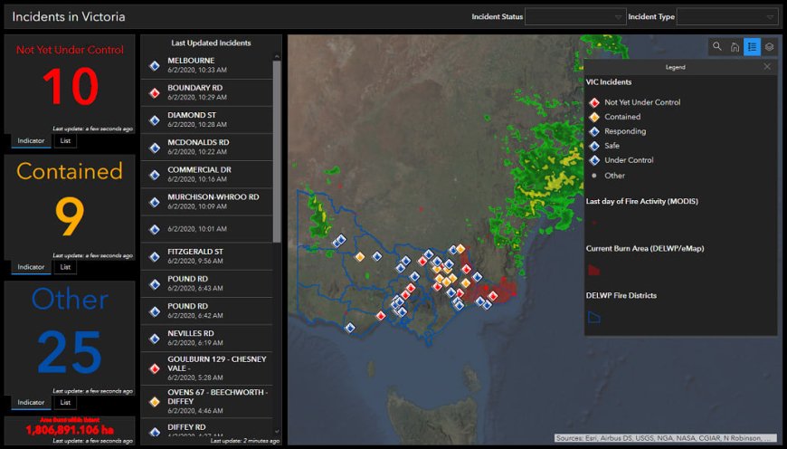
Geospatial technology also plays a pivotal role in providing real-time situational awareness during disasters. By integrating data from various sources such as satellites, weather stations, and social media, responders gain a comprehensive understanding of the evolving situation on the ground. GIS platforms enable the visualization of data through interactive maps, allowing decision-makers to monitor the progress of the disaster, track the movement of affected populations, and allocate resources effectively.
Effective Resource Management
During disaster response operations, efficient resource management is paramount. Geospatial technology facilitates optimal resource allocation by identifying the areas most in need and ensuring the timely deployment of personnel, supplies, and equipment. By overlaying geospatial data with population densities, infrastructure networks, and topography, response teams can make data-driven decisions that maximize the impact of their efforts and minimize response times.
Improving Communication and Collaboration
Geospatial technology serves as a powerful communication and collaboration tool in disaster response. Through GIS platforms, stakeholders can share real-time information, updates, and situational reports, fostering coordination among multiple agencies and organizations involved in the response efforts. This seamless exchange of data and insights ensures a unified and synchronized approach, enhancing the overall effectiveness of the response.
Leveraging Predictive Analytics
The utilization of geospatial technology in disaster response extends beyond immediate actions. It also enables the application of predictive analytics to anticipate and mitigate the impact of future disasters. By analyzing historical data, geographical patterns, and climate models, decision-makers can identify potential risk factors, develop early warning systems, and implement preventive measures to minimize the devastation caused by future disasters.
Case Studies: Geospatial Technology in Action
1. Hurricane Response and Recovery
In the aftermath of a hurricane, geospatial technology plays a crucial role in assessing damages, identifying affected areas, and prioritizing relief efforts. GIS platforms help responders create damage assessment maps, track power outages, and coordinate rescue operations. The integration of satellite imagery and aerial surveys enables the rapid identification of critical infrastructure damage, facilitating the efficient allocation of resources for recovery and rebuilding.
2. Wildfire Management
In wildfire-prone regions, geospatial technology aids in proactive wildfire management. Through remote sensing and GIS analysis, fire-prone areas can be identified, and fuel loads can be assessed. Real-time monitoring of fire progression using satellite imagery enables early detection, allowing authorities to issue evacuation orders and deploy firefighting resources promptly. Geospatial technology also assists in post-fire analysis, aiding in land rehabilitation and identifying areas susceptible to erosion.
Conclusion
The power of geospatial technology in revolutionizing disaster response is undeniable. From enhancing preparedness and planning efforts to providing real-time situational awareness, optimizing resource management, and facilitating communication and collaboration, geospatial technology empowers stakeholders to make informed decisions that save lives and minimize the impact of disasters. By leveraging the capabilities of geospatial technology, we can foster resilience, build safer communities, and ensure a more efficient response to future crises.
What's Your Reaction?


