Solving Urban Challenges: How Geospatial Analysis is Transforming City Planning
Discover how geospatial analysis is revolutionizing city planning by solving urban challenges. Explore the transformative power of geographic data and advanced technologies in shaping sustainable, resilient, and livable cities.

Introduction
In the ever-evolving landscape of urban development, solving complex challenges requires innovative approaches. One such approach that has gained significant traction in recent years is geospatial analysis. By harnessing the power of geographic data and advanced technologies, geospatial analysis has emerged as a transformative tool in city planning. This article explores how geospatial analysis is revolutionizing urban planning, enabling policymakers, architects, and city officials to make informed decisions that shape the future of our cities.
Understanding Geospatial Analysis
What is Geospatial Analysis?
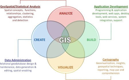
Geospatial analysis involves the collection, interpretation, and visualization of geographical data to gain insights and make informed decisions. It encompasses a range of techniques and technologies, including geographic information systems (GIS), remote sensing, satellite imagery, and spatial modeling. Geospatial analysis allows planners to understand the spatial relationships between various elements within a city, such as land use, transportation networks, infrastructure, and environmental factors.
The Role of Geospatial Analysis in City Planning
Geospatial analysis provides valuable insights into urban challenges by integrating multiple layers of spatial data. It helps identify patterns, trends, and relationships that are essential for effective city planning. Here are some key ways geospatial analysis is transforming the field:
1. Data-Driven Decision Making
By utilizing geospatial analysis, city planners can access a wealth of data that informs decision-making processes. They can analyze demographic information, socioeconomic factors, and environmental conditions to understand the specific needs and dynamics of different neighborhoods. This data-driven approach enables targeted interventions and optimized resource allocation.
2. Optimizing Infrastructure Planning
Geospatial analysis plays a crucial role in designing and optimizing urban infrastructure. It helps determine the best locations for transportation networks, utility services, and public amenities by considering factors such as population density, existing infrastructure, and accessibility. By analyzing geospatial data, planners can identify areas in need of improvement and allocate resources more effectively.
3. Enhancing Emergency Response
During emergencies, such as natural disasters or public health crises, geospatial analysis becomes invaluable for effective response and recovery efforts. It enables real-time monitoring and assessment of affected areas, facilitates resource allocation, and helps in identifying vulnerable populations. Geospatial analysis also aids in risk assessment and mitigation planning, making cities more resilient in the face of future challenges.
4. Sustainable Urban Development
Sustainability is a critical aspect of modern city planning, and geospatial analysis can contribute significantly to this goal. By analyzing environmental data, planners can identify areas prone to ecological risks and develop strategies for conservation and mitigation. Geospatial analysis enables the assessment of green spaces, urban heat islands, air quality, and other environmental factors, fostering the development of sustainable and livable cities.
Case Studies: Geospatial Analysis in Action
To illustrate the transformative power of geospatial analysis in city planning, let's explore a few real-world examples:
Case Study 1: Curbing Traffic Congestion
City planners in a bustling metropolis faced the challenge of heavy traffic congestion, leading to increased travel times and environmental pollution. By employing geospatial analysis techniques, they were able to collect and analyze data on traffic patterns, road networks, and public transportation systems. This analysis revealed specific bottlenecks and areas of high traffic density. Armed with these insights, the planners devised targeted solutions, such as optimizing traffic signal timings, introducing dedicated bus lanes, and implementing traffic calming measures. The result was a significant reduction in congestion, improved traffic flow, and enhanced commuter experience.
Case Study 2: Urban Heat Island Mitigation
Urban heat islands, characterized by higher temperatures in densely populated areas, pose challenges to public health and energy consumption. Geospatial analysis helps identify areas with excessive heat and understand the contributing factors, such as building density, vegetation cover, and surface materials. By analyzing this data, planners can develop strategies to mitigate urban heat islands, such as increasing green spaces, implementing cool roofing techniques, and strategically placing shading structures. Geospatial analysis facilitates evidence-based decision making, resulting in cooler and more comfortable urban environments.
Conclusion
As cities continue to grapple with numerous challenges, geospatial analysis emerges as a powerful ally in urban planning. By leveraging advanced technologies and harnessing the potential of geographic data, city planners can make informed decisions that shape sustainable, resilient, and livable cities. Geospatial analysis enables data-driven decision making, optimizes infrastructure planning, enhances emergency response, and fosters sustainable urban development. With its transformative capabilities, geospatial analysis is revolutionizing the way we approach and solve urban challenges. Embracing this innovative tool will undoubtedly propel cities towards a smarter and more prosperous future.
What's Your Reaction?


